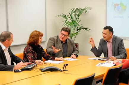
“Spatial is not just a tool, it is a different way of thinking. It’s a location-centric way of thinking...There is a little bit of spatial everywhere.”
Matti Seikkula is at ease as he talks about his prime interest for the past 19 of his 26 years in ICT - harnessing spatial or location information across public sector agencies and enterprises.
“I live and breathe spatial,” says Seikkula who is the CIO, enterprise architect and consultant at e-Spatial, New Zealand’s leading independent spatial consultancy firm, located in Wellington.
Utilising location data
Seikkula is calling for CEOs, CIOs and enterprise level managers to engage with spatial specialists, to find out how spatial can benefit their organisation.
Gartner points out how the Internet of Things and digital business will produce an unprecedented amount of location-referenced data. It is estimated that by 2020, approximately 25 billion devices will be permanently connected through the Internet, all of which will generate location data.
One such application of IoT data is the Street Bump mobile app of the City of Boston. Seikkula says the free app helps identify potholes by recording “bumps” on the road while users are driving. The data provides the city with real-time information to fix potholes, or to plan long-term investments to help improve roads. This is “a great example of sensor driven crowdsourcing”, he states.
Seikkula says spatial can offer additional insights and benefits to organisations and their customers that may not have previously been realised.
These include reduced operational costs (achieved by automation and tool/process efficiencies), increased productivity, improved customer service and better ability to recognise and mitigate risks, he says.
For example, with spatial access to location referenced data, a help desk becomes more able to access asset or customer information, enabling them to provide relevant local knowledge.
Insurance companies are better equipped to understand where their assets lie and any local risks that may impact on their safety.
Location of staff and assets alone is not as useful in isolation without all the spatial references around them, says Seikkula. Information on roads, rivers, parks, land, contours, places and addresses become important and add valuable information and context.
He points out spatial is not expensive anymore. Costs have reduced and piloting can be done with evaluation licences or open source licensing.
Seikkula, meanwhile, has recently been recognised for his work in the area.
Last November he won Professional of the Year at the New Zealand Spatial Excellence Awards, held in Wellington. This month, he was a finalist for the same category at the Asia Pacific Spatial Excellence Awards in Melbourne.

Read more: Movers and shakers: Rees Ward heads Wellington ICT Graduate School
He says in the past, the awards given by the industry went to technical analyst professionals. With the award in 2015 being given to a company CIO rather than a technical professional, “It highlights the fact the industry recognises that ‘spatial is not special’, but is integral across an organisation. CIOs need to be more mindful of the ‘big picture’ and how we can influence and benefit organisations at a strategic level.”
“Spatial is more about aligning business and IT, and the benefits that brings to an organisation,” he says. “Do not think of spatial as being different from any other technology.
“It’s not a silo industry,” he adds, “but more like the mobile industry where it can be embedded and integrated everywhere.”

360-degree impact
Seikkula has worked on a raft of spatial projects with both the government and private sector. Two recent projects of significance that have delivered major impact for clients are for Land Information New Zealand (LINZ) and the NZ Police.
LINZ is an organisation that is mature in its use of spatial. e-Spatial has been working with LINZ to determine better ways to connect property and address information by developing spatial models and frameworks. In recent times, e-Spatial has worked with LINZ on three major projects.
The Property Data Management Framework (PDMF) was produced for LINZ by e-Spatial to determine how property information, maintained and managed by disparate agencies, could be better connected. The earthquakes in Canterbury exposed the lack of consistency within property datasets held by different organisations, and led to an inability to easily and confidently connect or match data.
“Spatial reference data is important and any work done to improve these models, improving quality and accuracy, and making data more accessible, will greatly improve the lives of all New Zealand citizens,” says Seikkula.
In addition to the PDMF, Seikkula was also involved in the design and implementation of LINZ’s Address Information Management System (AIMS) that will enable councils to maintain and deliver their local addressing in a national model that will underpin all physical addresses in New Zealand.
The third project involves LINZ working to make it easier for non-spatial people to access and consume spatial data by way of a National Spatial Data Infrastructure (SDI). They have engaged e-Spatial to run workshops with potential government and commercial consumers to gain better insights on their future use of such a system, get their buy-in and ensure any resulting system would be aligned with the Government Enterprise Architecture (GEA) framework.
The NZ Police have been using location intelligence for many years, but this has been most prevalent in their backend systems. Seikkula’s role with NZ Police as a lead spatial consultant since 1999 has been to ensure spatial is incorporated into the wider police business, from business intelligence through to operations.
A key step in helping NZ Police embrace the benefits of spatial was to work with them to conduct a spatial review of their business and potential software systems under consideration.
Seikkula and his e-Spatial team defined NZ Police’s current and future functional requirements and potential transition plans, estimating the time and cost required to design, build and deploy.
Once such a review has been undertaken, customers are then able to move forward on the development of a spatial platform to better incorporate spatial into their business. NZ Police are now using spatial services on their systems and devices in the field to help achieve their goal of building a safer community, says Seikkula.

Spatial can offer additional insights and benefits to organisations and their customers that may not have previously been realised.
Skiing into ICT
Seikkula’s foray into ICT started at the age of nine in his native Finland, writing his first application built with Commodore VIC-20 and VIC Basic.
“It was a skiing game,” he smiles. At the age of 14, he had a summer job working on a supermarket cashier/inventory system using Nokia CP/M.
He completed a master’s degree in computer science minoring in economics, mathematics and statistics, at the University of Joensuu in Finland.
From there he held roles encompassing all facets of ICT - moving from developer, team leader, development manager and IT manager to the CIO of e-Spatial.
He is cognisant of the challenges CIOs face in the digital era.
“A CIO today has to be a Jack of all trades,” he says. “You need to understand the business, understand IT, have reasonably clear views on digital transformation, be almost like a chief digital officer, and understand where things are going digitally.”
He believes it helps if a CIO has climbed through the ranks, or still takes a bit of a “hands on” role.
“Industry expertise can be learnt through theory, but skills and experience can only be gained through practice,” he asserts.
“If you have never been part of the IT process lifecycles, for example, as a tester, developer or project manager, how would you ever understand what your people are doing?”
He says the role of a CIO can be vastly different in a small company versus a large commercial organisation. But whatever the organisation’s size, locale or sector, he says building a team that can work together and across technology shifts is critical.
“You can’t do everything yourself, you have to have good people around you,” he states.
“You need to encourage your team to come up with ideas and be able to implement them. It is also important to encourage the team to be willing to tell you why your idea may not make sense and the reasoning behind this.”

Why the CIO today has to be a 'Jack of all trades' @geomatti #digital #spatial #bigdata #leadership @cio_nz https://t.co/f2mJ7xTGXl
— Divina Paredes (@divinap) April 25, 2016
Send news tips and comments to divina_paredes@idg.co.nz
Follow Divina Paredes on Twitter: @divinap
Follow CIO New Zealand on Twitter:@cio_nz
Sign up for CIO newsletters for regular updates on CIO news, views and events.
Join the CIO New Zealand group on LinkedIn. The group is open to CIOs, IT Directors, CDOs, COOs, CTOs and senior IT managers.
Join the CIO New Zealand group on LinkedIn. The group is open to CIOs, IT Directors, COOs, CTOs and senior IT managers.
